Sunday, July 04, 2021


Coastal Highway

Next to the beach was a (slightly annoying) train track. It allowed for both passenger and cargo trains to go through. We happened to stay near a railroad crossing, and every time a train went through, you could hear it rumble. It wasn't much a problem during the day, and at night the trains would generally stop, but at 5 am, it was a little unpleasant. But during the day, the tracks provided the perfect leading line in an image. For this picture, I was flying the drone when a train went by. It might seem like I was lucky to be in the right spot at the right time, but with the frequency of the train, I had many chances to take the image. 

Saturday, July 03, 2021


Del Mar

My next adventure takes us to Del Mar, California. It is about 90 miles south of Los Angeles and is situated right on the water. Unfortunately for us, we arrived during June gloom, a time when most days have cloudy skies. For our first sunset, the clouds created a slight gap long between the Earth and sky. This trend continued for the rest of our stay, with most sunsets blocked by the clouds. Regardless, I was able to take some incredible images and some even without clouds.

Wednesday, June 30, 2021


Paths

For my final shot of this series, I return to the drone. I had received the critically low battery warning and needed to land. I looked down to find my landing spot when I noticed how the paths looked from above. They weren't straight or follow any structure. What you can't tell from this image is just how much mud is on them. You can faintly see the pool of water on the curved path on the left side, but other than that, it looks dry. My shoes and bike said otherwise.

Tuesday, June 29, 2021


Sunshine

For about an hour after sunrise and before sunset is a time called the golden hour. These minutes are when the sun is soft, and the light is very conducive to portraits, landscape, and all types of outdoor photography. For this shoot, I utilized the golden hour to capture some greenery around me. I was initially trying to hide the sun behind some plants but liked how the sun flare looked. I set some tall grass between my lens and the sun and snapped the image.
Monday, June 28, 2021


Concrete

Minutes before the sun's rays hit this part of the Earth, I sent the drone over towards downtown to capture its awakening. I made sure that the drone took this image before the sun rose so that there was no glare from all the windows. While it would have been nice to have a light yellow glow on the entire image, I decided that not having the glare was more important.

Sunday, June 27, 2021


Simplicity

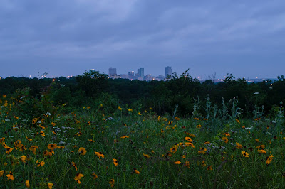
As the sun continued to rise, I wanted to capture the light along with the park and its surroundings. I had already taken many shots of downtown Fort Worth and wanted something different. I noticed the broadcast pole and made it the subject of my image. The image is simple, a pole dividing the brush. But I like this simplicity and feel it allows the colors in the sky to stand out. 

Saturday, June 26, 2021


To the City

In Tandy Hills Park is one main trail with a few split-offs. It had rained for multiple days before the 26th, and the main trail was caked with two inches of mud. With my shoes five pounds heavier, I pushed on closer to the interstate. I eventually found this little trail that created a perfect leading line towards downtown. I waited for the lighting to be optimal and the sunrise colors to shine, then snapped the image. 

Friday, June 25, 2021


Morning Light

My next step, as I typically do, was to send up the drone. By this point, the clouds were thin, and the sun was shining. When I sent it up, I was fascinated by the cars, shadows, and soft light on the ground. If I were to retake this picture, I would add an ND filter to the drone to allow for a longer shutter speed and make the cars a blur. Regardless, I still really enjoy this image and its simplicity. 

Thursday, June 24, 2021


Urban Nature

As the sun continued to rise, the clouds finally began to dissipate. Unfortunately, the eclipse ended at 6:22 am, and the clouds decreased well after then. While the clouds were blocking the eclipse, I pivoted and used them as a smooth, solid backdrop to allow the buildings to stand out. Also, I combined two shots to make this image, one focused on the flowers and one on the buildings. I felt the shots individually weren't the strongest, but together and with everything in focus, they create something great. 

Wednesday, June 23, 2021


Cloudy Mornings

Finally getting back to posting, I return to the morning of May 26 and the lunar eclipse. The eclipse itself was difficult to see due to clouds, but they didn't block my view of downtown Fort Worth. I set up my camera on a tripod, used my variable ND filter to darken the image, and tried to maximize the shutter length. After numerous attempts, I really like how it turned out; the crisp skyline, motion in the clouds, and the reflection of the city lights into the night sky all come together perfectly. 

Thursday, June 10, 2021


#0049

This image is one of the first Todd Hido emulations that I took. After being introduced to the idea, I set out that night with no intentions other than to follow Hido's ideas. When editing, I debated brightening the image to reveal more of the house or leave it dark and hide it. I ended up leaving it dark to make the image appear more mysterious and vague. More up to interpretation to the viewer.

Wednesday, June 09, 2021


#0078

A few days later, I began another adventure to capture life void of human existence. I chose to take images of this house for its structure. There are many sharp corners, angles, and geometric shapes. Unlike yesterday's, this image is the complete opposite. Opposed to the openness of the house, this one is closed and finished. The walls filled, and lights lit. Humans definitely have been living in this house. 

Tuesday, June 08, 2021


#0056

For this picture, I continued my nighttime drive through the neighborhood. This house is unique as it is the only one of this series that is unfinished. This uniqueness balances the series appropriately. Many times, we see the finished product. A finished picture, project, or house. But this picture shows the unfinished nature of things. The fact that perfection and completeness aren't instantaneous, rather a culmination of many hours of work. 

Friday, June 04, 2021


#0041

Next, I found this house with an American flag flying on its porch. It was illuminated by two lights, and I wanted to make it the subject of the image. I carefully positioned myself such that the pole didn't block the flag, and I could capture the reflection of the flag on the front door. The next challenge was finding the balance in light between the bright flag and dark sky. I made the priority the flag, since it is the subject, but made the overall composition slightly above the brightness I typically shoot at to compensate for the sky. 

Thursday, June 03, 2021


#0033

After a short drive, I showed up at this second house. Many of Hido's images appear during a storm. But when you can't produce a storm on demand, it makes emulating a little difficult. To compensate, I used a trick Hido himself uses, water. I fill a spray bottle with water then spray it onto the lens. This action blurs the image and adds an interesting element to it. There is a possibility of the water getting into the camera from this process, but most modern cameras are water-resistant, and I made sure to avoid spraying the body. 

Wednesday, June 02, 2021


#0005

As I mentioned a few days ago, the next series will be one about the images I created during my school photography class. In early January, I received an email from my teacher with a link to a Youtube video. The video describes the work of Todd Hido. Hido photographs manmade structures, typically during the night or a storm, void of human figures. The idea is to create an image that has a different meaning to each viewer. For this reason, he doesn't title his images. Instead, he uses the number given by the camera. Over the next nine days, I will be posting my emulations of his work.

Tuesday, June 01, 2021


Nightlights

A few days later, I went on another adventure. This one was back at a park I venture to frequently. But that was not the focus of the image. The focus was the highrises of downtown Dallas. I lined up as best I could on the road leading to downtown, adjusted the settings to capture the dark subjects, and took the image. It was cloudy that day, which meant that all the lights in the city reflected off them. This made the clouds appear in two different colors, violet from the night and orange from the incandescent bulbs. 

Monday, May 31, 2021


East Dallas Sunset

As the sun continued to set, I changed locations yet again. My next stop was Flag Pole Hill, one I know all too well from running. But instead of focusing on the hill, I focused on the road leading to downtown and the sunset. Similar to the picture from two days ago, there was nothing I could do to avoid the sun. So, I made it the main subject of my image. I angled the camera to get the best sun flare possible and positioned the drone so there it created a reflection off the road. These two actions, paired with the colors of the sunset, allowed for a magnificent composition. 

Sunday, May 30, 2021


Humans and Nature

After biking around the lake, I came across one of many docks. This one happened to have a flock of birds in the water across from it. I was a little disappointed when I first took the image, but I like the muted colors more and more. The grass is not green, and the trees don't have leaves on them, but this makes the birds and people stand out more. The water is a weird brown-green color, and I'm sure it's not environmentally healthy, but I think it looks interesting. 

Saturday, May 29, 2021


Blue Skies

My next adventure led me to White Rock Lake, where I was greeted with blue skies and gusty winds. These winds wouldn't have been much of a problem, but I had recently updated the drone and was not accustomed to the new direction-awareness system. This system tells you where the drone is relative to the controller and which direction it is facing. Regardless, I decided to test it out and flew anyways. The next problem was trying to shoot west towards downtown, right where the sun was. I thought about lowering the camera angle and avoiding the sun altogether, but that didn't help. So I figured, might as well include the sun instead of trying to avoid it. 

Friday, May 28, 2021


Winters Night

After adjusting the camera angle from the last image, I was delighted by this sight. I kept the same settings (0.8sec, f2.8, 100 ISO) which allowed for the motion of the cars to show. The sunset portion of the image is a second image that I took minutes before this one. If you don't know, the Dallas North Tollway runs almost directly north-south, and the sun doesn't set in either of those directions. So, about twenty minutes after sunset, I took an image of the colors above the already set sun. Then moments later, I took one of the moving cars. I combined the two, and it turned out like this. 

Thursday, May 27, 2021


Motion

This image is one that I have been waiting to post for a while. One night during the Holiday Break, I biked over to the Dallas North Tollway and sent the drone up. It must have been a very calm night, as the drone was steady enough to take a 0.8-second shot. I was surprised when I saw this image since I wasn't expecting a long exposure from the air to work. But now that I know it does in the calmest winds, I will be emulating this image with other subjects. 

Wednesday, May 26, 2021


Eclipse

I bet you weren't expecting this post today, but how could I miss such a fascinating event! The day started with a 4:30 alarm, followed by a thirty-minute drive, followed by an introduction to my new favorite park. I had known about the May 26th lunar eclipse for quite a while but couldn't find a place near home but also far from city lights. I settled on Tandy Hills Park, off Interstate 30. The viewing of the eclipse was sporadic, as the clouds decided to invade my photographing of it. How rude! But, there were a few seconds when the clouds broke and provided me with a glimpse of the event. A lunar eclipse occurs when the Earth blocks the sun's light before it reaches the moon. The timing of this picture is before the total eclipse, which is why the moon looks like a regular crescent. Regardless of the clouds and regular-looking moon, the view from the drone was superb. It is odd for me to post twice a day, but I could not wait to post this taste of the lunar eclipse (the whole eclipse series is coming after the winter drone series). 


Baseball

As I continued my bike ride south, I noticed this baseball diamond. I have taken a few pictures near the area, but never from a drone. I took this picture a few minutes before 5, which made the shadows long and light soft. Throughout the image, the subjects are cast in different lights. Treetops in a bright orange or green, the baseball diamond and park a soft yellow, the lake a dark black, and the pathways a light gray. It is a unique way to see the park, one that I have never seen before. 

Tuesday, May 25, 2021


Stormy Skies

After a brief break to finish up my school work, I am back! This next series will be nine days straight of drone images I took in Dallas in December and January. After this short series, I will post another series that I have been working on for my school photography. Then following that series, I will begin posting more recent images. 

This image comes from December 19th, 2020, and back when there was still some color on the trees. What I like most about it is the rays of sunlight and how the image's composition splits into three sections. The lower half is of homes, the upper left is downtown, and the upper right is the sun. The original image was relatively dark, but nothing some Photoshop can't fix. 

Friday, May 07, 2021

Cloudy Skies

After taking the last picture, I biked a few miles to the north and found myself near a major road. I chose to stop here because I knew that the road's line would help guide your eyes to the focus of the image, the Dallas skyline. It also happened to be partly cloudy that day, which gave some fascinating sun streaks in the right half of the picture. I never planned to wait for the perfect lighting, but I think this time, the lighting was waiting for me.

Wednesday, May 05, 2021

Downtown Dallas

Back in Texas, I spent several days flying it and taking pictures of Dallas from above. This first image is looking at downtown Dallas from the northwest. I ended up putting it in black and white because I didn't feel that color added any benefits. There wasn't much color in the sky, and the trees were either brown or pale green. This is eventually a theme I realized while looking over the pictures and am waiting for the days when the trees gain some color and the grass is not brownish-yellow. 

Tuesday, April 27, 2021


Road to the Next

As we wrap up this series, I wanted to end it with a similar picture of how I ended the summer Colorado series. I walked into the middle of the road (yes, I was very aware of cars coming by) and aligned myself with the center divider. The clouds were continuing to work their magic, and the almost setting sun eliminated the harsh light. I believe that the summer picture has better scenery than this one, but this one has snow and interesting-looking clouds, so I guess they balance out.

Monday, April 26, 2021


Forest Service Road 650

Once again, about twenty feet into the air, there was something magical at that height. You can't quite see over the trees, but you are high enough to see most of the mountains in the background. Forest Service Road 650 seemed like a lightly traveled road that is the only winter-time entrance into the town of Ophir. We parked between the highway and town, far enough from both that we didn't hear the sounds of either. Besides the occasional car coming by every five-ish minutes, the only other sounds we heard were those of the birds. 


Between the Mountains

Still, at an altitude of 1,600 feet above my starting point, I turned the camera around and moved the drone a couple of hundred feet to the north. I wanted to get a little closer to the roads and see if I could notice anything behind the mountain to the right. When I was talking about pictures being blue a long time ago, this is the image that I had in mind. It might be because of the white snow and the darkness in the valleys, but for some reason, the mountainsides are very blue. 

Sunday, April 25, 2021


Surrounded

After reaching a height of 1,600 feet above my starting altitude, I looked directly down. I saw the dirt road on the left side, a small stream on the right, and trees on both sides. I had a little trouble deciding which line I wanted to align the picture with, but I eventually settled with the tree line. I thought about choosing the road, but it wasn't entirely straight. So, the only other option was the tree line. I wouldn't call it the best alignment, but I think it's pretty good. 

Saturday, April 24, 2021


Rugged

Next, I turned the drone to face the surrounding mountains. Something seemed special about the rocks sticking through the snow and half of the mountain being entirely white. To make the picture appear older, I significantly lowered the saturation and vibrance. Not completely to zero, but very close. It really increased the contrast while keeping a hint of color in the image. 

Friday, April 23, 2021


Ophir

The next part of this adventure involved turning down an unnamed dirt road after seeing some interesting-looking houses. I didn't know it yet, but from 1,500 feet, I could clearly see the small town of Ophir nestled in the valley of these mountains. Something that bothers me about this picture is the town's slant. It is not perfectly flat but slopes to the right. This is just a minor detail that annoys me since I am the photographer, but I still think it is an amazing image. 

Thursday, April 22, 2021


Shadow

When one of the drone batteries became a little low, I looked down, trying to align myself for a landing. I found the landing spot, but I also found these trees next to me. I saw I had about six more minutes of flight time and took a detour. And what I saw was unlike anything I had seen before. The almost setting sun made for some great shadows, and there were some very nice shadows from the trees. I knew this image had to be in black and white, but besides that, I didn't change anything else. I wanted the picture to speak for itself and to show the unedited scene. 

Wednesday, April 21, 2021


The Road Home

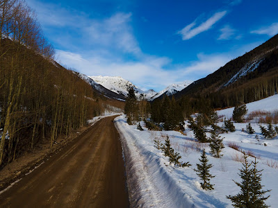
You probably thought that the title meant that this adventure was over, but it's not. I just like how it reflects what we used the road for. Similar to some other recent pictures, the road winds its way to the back of the image where the main subject is. I also like the contrast within the image. On the right side is a large group of trees, while on the left side is a mountain. 

Tuesday, April 20, 2021


Clouds

After flying around for a bit, I found this mountain. In retrospect, I probably should have flown a little higher and tried to match the altitude of the peak, but this vantage point still looks incredible. What makes the image for me is the very wispy clouds. In the lower half of the image, you have the beauty from the mountain, with the trees and their shadows, and the peaks ruggedness. In the upper half, you have the soft clouds. Everything flows so nicely together, and it is hard to look at this without feeling a sense of calmness. 

Monday, April 19, 2021


Curved

After leaving Trout Lake, we continued west, stopping and pulling off to the side of the road many times. This first stop was next to a large, mostly untouched area. Whenever I take off or land the drone, for some reason, everything looks better from twenty or thirty feet in the air. This image, for example, I'm sure would look good from the ground but looks a whole lot better from this vantage point. Maybe it's because we don't typically view things like this, or it's just this specific image, either way, I really like this picture. 

Sunday, April 18, 2021


Aspens

On the side of the road were a group of Aspen trees. I took a little stroll through the muddy road and centered myself with the bunch. The picture itself is relatively simple, a picture of trees. I then adjusted the tilt of the image to make the middle tree vertical, turned the picture black and white, and added a whole lot of contrast. I don't think any of those adjustments were necessary, but they add another level of depth to the picture. 

Saturday, April 17, 2021


Isolated

I found this house half a mile down Trout Lake Road. Trout Lake road is not a paved one, but a dir one, and the snow had been removed from it but was a little muddy. It was not the prettiest way to get to this spot, but the views were incredible. To edit this picture, I wanted to highlight the singular house. I did so by decreasing the saturation of the entire image, then increasing the saturation of just the reds, which is the color of the house. This made the picture seem dull while the house looks vibrant. 

Friday, April 16, 2021


Alpine Peaks

For this final drone picture from Trout Lake, I found a little gap between two peaks that allowed me to see for miles. In the foreground of the picture, you can see the road snaking through the image. But the further you look back, the more it disappears and the more the mountains appear. I would like to say that I intentionally kept the focus very crisp on the mountains in the background, but I am not advanced enough to know how to do so. 

Thursday, April 15, 2021


Open

From 1,600 feet up, the valley floor turned into a vast emptiness. There are very few markings (besides the obvious road in the middle) and the only contrast in the picture between the black trees and white snow. The trees have no real structure as they just look like black points. Then you look back at the very crisp mountain and the wispy clouds. Once again, there was a slight blue hue to the image, but a quick edit in Photoshop cleared most of it up. 

Wednesday, April 14, 2021


Road to the Mountains

After turning the camera to face south, I found this road snaking through the valley floor. It is appropriately named Trout Lake Road, who would have thought. The lake was also where I saw some film being shot. As we were driving away, I noticed some 'crew' signs on the side of the road. Then, as we drove further west on CO-145, I saw a large gathering of people and some cameras. I am not sure what they were filming, but I guess this frozen lake in the middle of Colorado was the perfect spot. 

Tuesday, April 13, 2021


Trout Lake

For my next adventure, I turned to Google Maps. I found a lake nearby CO-145, dropped a pin so I would have directions even out of cellular coverage, and went. It was strange how a drive of only eleven miles revealed an entirely different landscape. It wasn't like a transition from winter to summer, but the views were all new. For this picture, I noticed this house positioned below the untouched landscape and mountain peaks. I wanted to capture this with an isolated feeling, and I did so by going high into the sky and photographing as much of the view as I could. 

Monday, April 12, 2021


Rays of Sun

As the sun continued to set, I turned around and faced the town. This picture ended up being the last one I took for the night. Not because the battery was running low or it was too cold, but because I took a video of the sun setting. Of the many picture and video options on the drone, one of them is hyperlapse. What this mode does is it takes many pictures (this specific one was 250) and compiles them together. Think of it like a timelapse feature, just from a drone. Hopefully, I will have posted the video by the time this post comes out, and you all can see the mountains turning from orange back to white. 

Sunday, April 11, 2021


Bald Mountain

As we continue to plow through the series (day 20 of 45), I was reminded of a recent picture. The sky above Bald Mountain reminds me of the sky above Seaside from the Florida series. The baby blues, greens, and oranges all forming this gradual transition from color to color. Then you look down at the mountain and notice the ski runs twisting and turning all over the mountain. And to top everything off, there is the hint of orange on a singular western-facing slope. I don't think I have seen a better image of Bald Mountain. 

Saturday, April 10, 2021


Shadows

This next picture is a simple camera rotation from yesterday's one. There was something about these mountains that was calling me to post them. Maybe it was the orange sun that hit only the western-facing slopes or the completely untouched snow and exposed rocks, but whatever it is, it is magnificent. Also, at the bottom of the picture is Mill Creek Road. This is just one of many hiking and offroading trails that are around Telluride. Right now, they are just lines in the mountain, but once summer hits, they are frequently visited and is definitely something I want to do in the future.

Friday, April 09, 2021


Mountain Top Sunset

After picking up some food from Telluride, I noticed the sky turning into some wonderful colors. Out of all of my skiing trips, this is the very first one where I was able to capture a colorful sunrise or sunset. For some reason, the sun has never cooperated while I have been in Colorado in the winter. But for this night, it did. The lower sky turned a bright orange, the upper sky a dark blue, and the clouds a vibrant yellow. I am not sure what more I could have asked for. 

Thursday, April 08, 2021

Telluride

As I began the long flight to the parking lot, I stopped for a second to appreciate the view looking west. The tiny town of Telluride is situated in the valley of multiple 14,000-foot behemoths. Luckily, it had just snowed, and these mountains were a wonderful shade of white. For some reason, there was a slight issue with the white balance of the camera, as all the pictures (especially this one) turned out slightly blue. I am not sure whether that is just a side effect of shooting a white object or if it happens to all drones, but some minor corrections in Photoshop fixed most of the mistakes. 

Wednesday, April 07, 2021

Bridal Veil Falls

This is Bridal Veil Falls, if the title didn't give it away. It is a 365-foot tall waterfall accompanied by the Bridal Veil Falls hydroelectric powerplant at the top of it. The distance to the falls was much further than I originally planned. I simply put in a fresh battery (thankfully) and started flying towards the falls. And 5,460 feet later, I reached this point. I was a little nervous sending it all this way but was very satisfied with the performance; a perfect 5/5 signal from a mile away, very long battery life (30+ minutes), and zero close calls. I'd call it a successful day!

Tuesday, April 06, 2021


San Juan Mountains

Next on the adventure was a trip to Pandora, Colorado. You may recall my description of Pandora from an earlier explanation, but I have since learned that it was an abandoned mining town. On its east side is Trico Peak, the peak in the middle of this picture. The parking lot for this view is a decent way back from the actual mountain and falls, far enough to get a view of the whole scene but too far to see any details. But that sounds like the perfect job for the drone! This first picture comes from very far away, but tomorrow I venture closer to the falls.